Hasso-Plattner-Institut
Prof. Dr. Jürgen Döllner
 

What is Digital Engineering?

Digital Engineering is concerned with the engineering-driven methods, principles, and techniques used to design, build, analyze, operate, manage, and integrate digital systems, such as software-intensive IT systems, applications, and services. As an interdisciplinary approach, it includes  

  • IT systems engineering, computer science and software engineering
  • Data Science, Mathematics and Statistics
  • Economics and Law
  • Entrepreneurship and Innovation Management

Digital Engineering investigates and develops approaches and strategies to provide effective methods and reliable processes for the entire life cycle of digital systems. It focuses not only on the technical artifacts that are the subject of analysis, design, implementation, testing, and operation of digital systems, but also on the corresponding development processes, the stakeholders involved, the needs and requirements for the system, the overall evolution of the system throughout its life, and its integration into real-world processes, tasks, and economic and social contexts. 

Digital Engineering is the key to overcoming the multiple weaknesses of digital system development, known as the "software crisis", which is increasingly becoming a major obstacle to the growth and operation of almost all companies as they transform into software-based enterprises - often known as "software eats the world". In a sense, Digital Engineering aims to transform software engineering into a kind of "real engineering", e.g. through transparency for all stakeholders, effective management of teams, precise control of progress and holistic monitoring of IT developments. Digital Engineering is not tied to specific programming languages, programming paradigms, middleware, development methodologies, or development environments. 

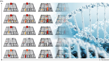
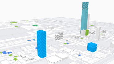
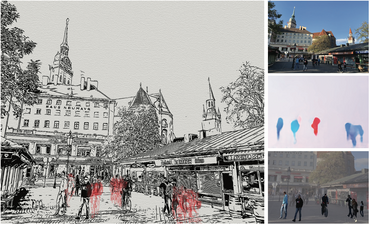
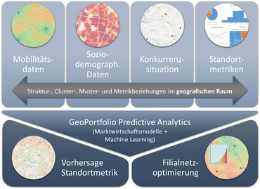
At the chair of Prof. Döllner, Digital Engineering focuses on technologies and AI for computer graphics, visual computing, multidimensional feature spaces, information visualization, geospatial information, and digital twins. 


Research and Development Initiatives

  • AI Lab for IT-Systems Engineering: HPI has established a joint research lab for AI for IT systems engineering, funded by German Federal Ministry of Education and Research BMBF (2019-2021); the laboratory includes the HPI groups of Prof. Bert Arnrich, Prof. Jürgen Döllner, Prof. Tobias Friedrich, Prof. Robert Hirschfeld, Prof. Lippert, and Prof. Christoph Meinel. 
  • ZIM Kooperationsnetzwerk „twin4bim”: HPI is member of the cooperation and research network “digital twins for building information models” of the GeoKOMM network (https://www.geokomm.de/twin4bim.html).
  • GraphicsVision.AI: HPI is founding member of the not-profit international network GraphicsVision.AI that joins international research institutions and innovation driven companies and that share a common vision and interest in technologies such as Computer Graphics, Multimodal-Multimedia, Visual Interactive Digital Media, Visualization and Simulation, having a strong focus on Artificial Intelligence and Machine Vision and Learning (https://graphicsvision.ai/). 

Research and Development Projects

Software DNA

Software DNA investigates concepts and techniques for visualizing characteristic features of the software modules and of the related software development process (“Software DNA”).

Details

TASAM

TASAM investigates and develops information visualization techniques used for temporal, animated software analytics maps.

mdViPro

mdViPro investigates and develops AI-based methods and techniques that abstract, stylize, and generalized multidimensionale visual media contents.

Geoportfolio

Geoportfolio aims at developing analytics instruments that allow for understand, evalute, and visualize location-based characteristics such as for shop locations and point-of-sales.

PunctumTube

PunctumTube investigates and develops methods and techniques for the AI-based processing of massive 3D and 4D point cloud data.

MobiDyn

MobiDyn investigates how to generalize and consolidate spatial trajectory data.

IBDAV

IBDAV concentrates on machine sensor data and its integration into information systems.


QViZO

QViZO investigates methods and virtualization techniques for temporally changing spatial environments using multi-sensor systems. 
 

East Jersualem Virtual 3D City Model

Towards social inclusion in community development by providing platforms for planning and advocacy.